


 |
|


If you never used Trackandroad motorbike roadbooks creation software, or if you want to know all its possibilities, just follow the steps of this tutorial. Before you start, open the page http://www.trackandroad.net/motorbike-roadbooks in a new tab / window.
Here is the .tnr file which contains the whole tutorial actions. Download it if you get lost.
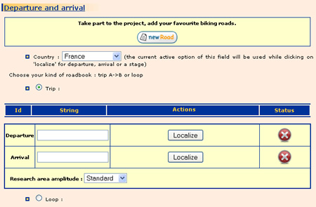
Go in the eponym section, set 'France' in country menu and type 'palaiseau' in the start field. Click on 'locate'. 'D' marker will appear in the middle of Palaiseau city.
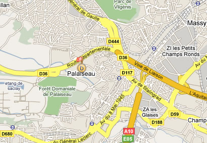
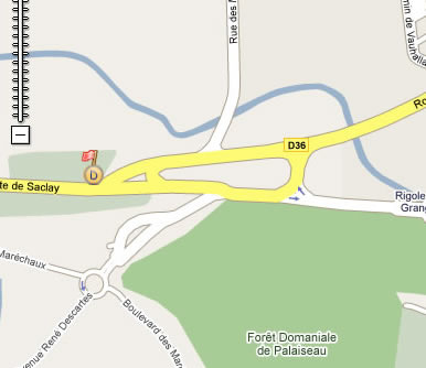
Click twice on the + command of the zoom, then drag and drop the marker at Palaiseau exit.
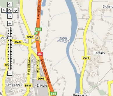
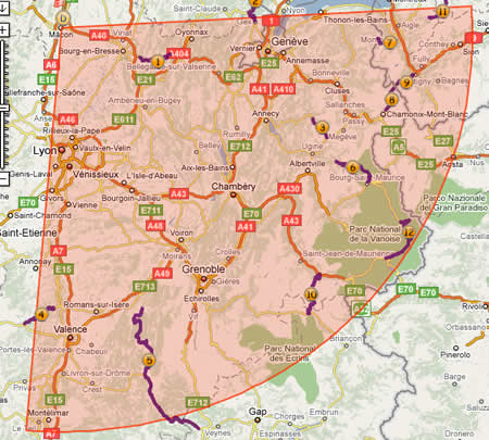
Click on 'zoom back to initial map', under the map. Go back to the table, let arrival field empty and click on locate. A marker will be set up in the middle of the map. Move it at the north of Lyon.
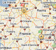
You will now define more accuratly its location using zoom button  , then drag and drop it at the north of Villefranche sur Saone (move, zoom up and down to achive your goal) .
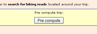
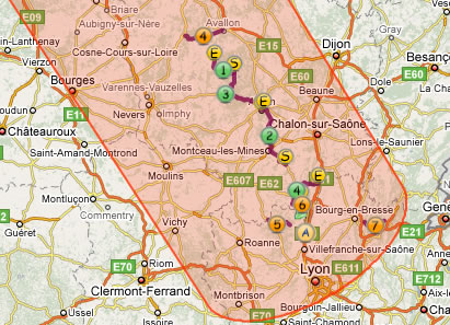
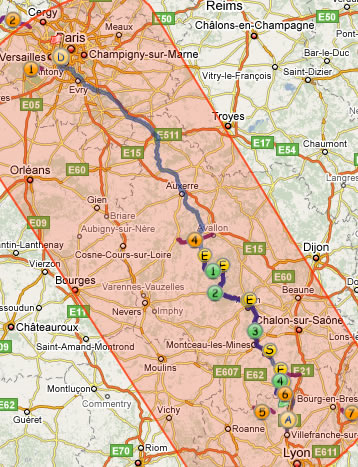
Well, departure and arrival are set up. Now, it's time to search for biking roads which are along your trip. Click on 'Precompute' button.
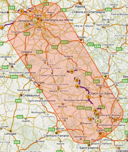
The research area and roads (referenced by a number  ) are displayed on the map :
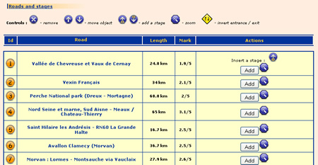
They are also listed in a table under the map :
NB : If you wish to have a wider research area, change value of option 'amplitude of research area' (3rd line of 'Departure /Arrival' table) an click on 'Precompute' again.
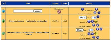
The roads in the table are now only 'suggested'. you will have to add them to the roadbook. Go to the line of Morvan : Lormes - Montsauche via Vauclaix and click on 'Add' button. Do the same with The heart of south Burgundy, Morvanexpress : Montsauche - Chateau Chinon - Autun et Outskirts of Macon. Roads icons turn to green on the map  , and are now at the top of table.
A quick look on the itinerary shows there are some details to improve :
 , or select 3 in pop up menu and click on 'move'. :
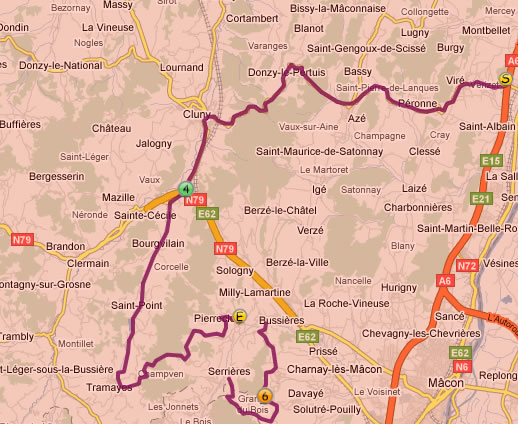
 at the road line in the table.
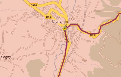
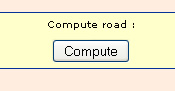
Your roadbook can now be computed. Click on 'Compute' button.
Some informations are now displayed :
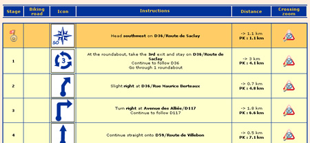
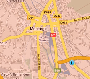
The south part of the trip is OK, but, before you reach road N°1, you would like to go a bit more western, for example having a step in Montargis. Insert a step before road N°1 by clicking on  .
.
Type 'Montargis' in the field, and click on 'Locate'. The step icon  is set up in the middle of city. Drag and drop it at the south west exit of the city.
Now you just have to click on 'Compute' to modify your road.
This is great, but how can I use it on the bike ?? Let's have a look :
 '. A printer formatted window opens.
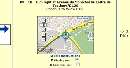
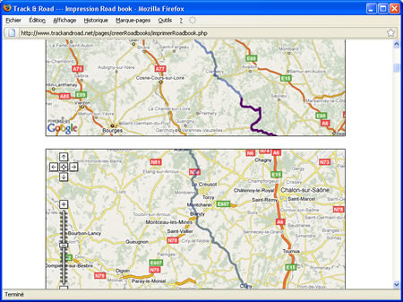
And click on Print when you are ready !
You want to save your job, or to share with friends or members of you moto club. Save it as a .tnr. Go at the top of page, at 'Load / Save roadbook'. Click on 'save roadbook'.
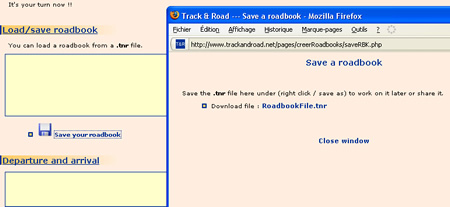
Right-click on FichierRoadbook.tnr in the pop up window which just ope, and save the file.
Close your browser, and re-open tha page http://www.trackandroad.net/motorbike-roadbooks, which is empty again. Go to 'Load/save a roadbook'. Click on 'Browse', select the file you just saved and click on 'Open'. The page now opens with all the data you previously saved, and you can modify your work.
And if I do not want to go from A to B, but to do a loop around a given point ?? It's simple. At the beginning, click on 'loop'. A different table will appear :
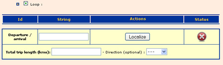
Locate the 'departure/arrival' point as you did previously; then type a total length (homeward+return), an orientation (optional) and click on 'Precompute'.
The floowing remains the same !
