banniere TrackandRoad
| Connect

Aidez le site : faites un don Paypal

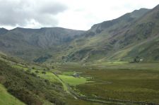
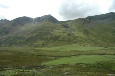
Welsh mountains

Take part

Don't forget to publish your favourite biking roads.

Use Motorbike-roadbooks

You can create custom roadbooks based on these roads by using software Motorbike-Roadbooks. For a first use, you can have a look at the tutorial.

Map

Zoom back to initial map

Description

If, like I did, you imagine that Wales are totally flat and full of sheeps, I hope that you will change your mind by reading this page.

Indeed, northern wales are the paradise of outdoor activities, including of course motorcycling !!

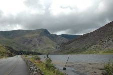
This road provides you a lot of curves on a great qualicy surfacing, in great natural landscapes...So, you know what you have to do !
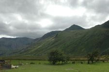
Pictures


Llyn Ogwen lake

Marks

The roadbook

81 km (about 1 h 13 min)

Stage Instructions Distance Zoom crossing
Dolgellau 0 km
1 Head northwest toward A493 PK : 0 km
(-> 0.4 km)
2 Turn right at A493 PK : 0.4 km
(-> 0.1 km)
3 Turn left at A470
Go through 1 roundabout
PK : 0.5 km
(-> 23.1 km)
4 Continue on A487 PK : 23.7 km
(-> 3.3 km)
5 Turn right at A496 PK : 27 km
(-> 7.6 km)
6 Turn left at A496/Benar Rd PK : 34.7 km
(-> 0.1 km)
7 At the roundabout, take the 1st exit onto A470/Llwyn-y-gell Rd
Continue to follow A470
PK : 34.8 km
(-> 4.2 km)
8 Head northeast on A470 PK : 39 km
(-> 13.2 km)
9 Continue on Ffordd Craiglan PK : 52.2 km
(-> 0.2 km)
10 Turn left at A5 PK : 52.5 km
(-> 4.8 km)
11 Turn left to stay on A5
Destination will be on the left
PK : 57.3 km
(-> 23.4 km)
Bethesda 80.8 km

Nearby roads

  • See roads closer than : kms

There is no road closer than 100 kms. Increase research radius (max 250 km).

Nearby Accomodations

  • See accomodations closer than : km

Research radius : 100 km

Name Type Distance / Active road Mark Zoom
The old Vicarage Bed and breakfast 42 km 3.6/5

Your opinion

There is no opinion about this road yet.