banniere TrackandRoad
| Connect

Aidez le site : faites un don Paypal

Achill Island

Take part

Don't forget to publish your favourite biking roads.

Use Motorbike-roadbooks

You can create custom roadbooks based on these roads by using software Motorbike-Roadbooks. For a first use, you can have a look at the tutorial.

Map

Zoom back to initial map

Description

Located in the far west of Ireland, this island is dark, amazing....just have a walk in Slievemore deserted village and you will understand. Oh, road...bad surfacing and almost no curves. So, enjoy landscapes, they are so beautiful.
Pictures

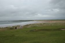
Plage de Doogort
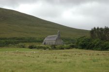
Eglise de Doogort
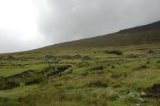
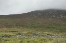
Village déserté de Slievemore
Village déserté de Slievemore (2)

Marks

The roadbook

29.4 km (about 43 min)

Stage Instructions Distance Zoom crossing
Dooagh 0 km
1 Head east on R319 toward Keel W/R319 PK : 0 km
(-> 7.5 km)
2 Turn left to stay on R319 PK : 7.5 km
(-> 0.2 km)
3 Turn left at Slievemore Rd PK : 7.8 km
(-> 1.8 km)
4 Turn right toward Slievemore Rd PK : 9.6 km
(-> 0.2 km)
5 Continue straight onto Slievemore Rd PK : 9.9 km
(-> 3.8 km)
6 Slight right at Pier Rd PK : 13.8 km
(-> 0.7 km)
7 Continue on Beach Cottages PK : 14.5 km
(-> 2 km)
8 Continue on Tonatanvally
Destination will be on the right
PK : 16.5 km
(-> 0.1 km)
9 Head east on Tonatanvally PK : 16.7 km
(-> 0.7 km)
10 Slight right toward R319 PK : 17.4 km
(-> 4.3 km)
11 Turn left at R319
Destination will be on the left
PK : 21.8 km
(-> 7.6 km)
Achill sound 29.4 km

Nearby roads

  • See roads closer than : kms

There is no road closer than 100 kms. Increase research radius (max 250 km).

Nearby Accomodations

  • See accomodations closer than : km

Research radius : 100 km

Name Type Distance / Active road Mark Zoom
Sleepzone connemara Others 38 km 3.1/5

Your opinion

There is no opinion about this road yet.